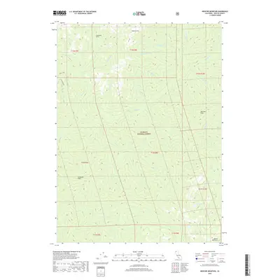
2018 Map of Medicine Mountain
USGS Topo · Published 2018About this map
Medicine Mtn stands as a central topographic anchor in this 2018 survey of the Klamath National Forest in Siskiyou County. The landscape is defined by the sharp verticality of Steinacher Ridge and Hell Hole Ridge, which drop into an intricate drainage network including Wooley Cr and its northern fork. In the southern reach, the terrain transitions into the Marble Mountains, where high-elevation basins hold Clear Lake, Lost Lake, and Lily Lake. The map reveals the hydrology of a deeply dissected forest environment, showing where smaller tributaries like Bear Skull Cr and Dead Horse Cr feed larger watercourses. This modern data captures the complex ridgeline boundaries and gulch formations, such as Snowslide Gulch, that dictate the movement of water and wilderness travel throughout this portion of Northern California.
Find a feature on this map
35 named features on this map. Tap any name to fly to it.
Don’t see what you’re looking for? This feature index may not catch every label — zoom into the map to look around manually.
Map Details
Editions of this 2018 Medicine Mountain Map
This is the sole edition of this map. No revisions or reprints were ever made.
Other maps of this area

1914 · Seiad
USGS Topo · 1:125,000

1922 · Seiad
USGS Topo · 1:125,000

1948 · Weed
USGS Topo · 1:250,000

1950 · Weed
USGS Topo · 1:250,000

1955 · Sawyers Bar
USGS Topo · 1:62,500

1955 · Ukonom Lake
USGS Topo · 1:62,500

1955 · Scott Bar
USGS Topo · 1:62,500

1955 · Forks of Salmon
USGS Topo · 1:62,500

1958 · Weed
USGS Topo · 1:250,000

1963 · Weed
USGS Topo · 1:250,000