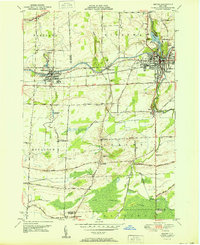
1951 Map of Medina
USGS Topo · Published 1951About this map
The Erie Canal and the New York Central railroad corridor define the industrial and transit heart of this Western New York landscape in the early 1950s. Centered on Medina and Middleport, the area shows a transition from structured municipal grids to the rural expanses of Hartland and Royalton. A significant archaeological note is found in Shelby, where the Site of Neuter Fort is recorded near Jeddo Creek.
Find a feature on this map
59 named features on this map. Tap any name to fly to it.
Don’t see what you’re looking for? This feature index may not catch every label — zoom into the map to look around manually.
Map Details
Editions of this 1951 Medina Map
This is the sole edition of this map. No revisions or reprints were ever made.
Other maps of this area

1897 · Olcott
USGS Topo · 1:62,500

1897 · Medina
USGS Topo · 1:62,500

1897 · Lockport
USGS Topo · 1:62,500

1897 · Ridgeway
USGS Topo · 1:62,500

1899 · Niagara
USGS Topo · 1:125,000

1902 · Lockport
USGS Topo · 1:62,500

1905 · Lockport
USGS Topo · 1:62,500

1944 · Ashwood
USGS Topo · 1:31,680

1948 · Lockport
USGS Topo · 1:62,500

1948 · Olcott
USGS Topo · 1:62,500