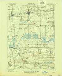
1897 Map of Medina
USGS Topo · Published 1944About this map
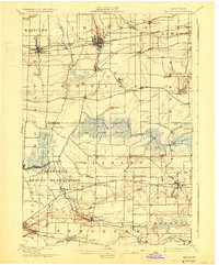
Tonawanda Indian Reservation occupies the southwestern quadrant of this 1890s landscape, where the waters of Tonawanda Creek and Murder Creek wind through the borderlands of Niagara, Erie, and Genesee Counties. To the north, the industrial and transport corridor of the Erie Canal serves as the primary artery for commerce, linking settlements like Medina, Middleport, and Knowlesville. The influence of the New York Central and Hudson River railroad is evident, paralleling the canal and supporting the growth of these transit-oriented villages.
Find a feature on this map
59 named features on this map. Tap any name to fly to it.
Don’t see what you’re looking for? This feature index may not catch every label — zoom into the map to look around manually.
Map Details
Editions of this 1897 Medina Map
7 editions found
Other maps of this area

1897 · Albion
USGS Topo · 1:62,500

1897 · Olcott
USGS Topo · 1:62,500

1897 · Medina
USGS Topo · 1:62,500

1897 · Lockport
USGS Topo · 1:62,500

1897 · Oak Orchard
USGS Topo · 1:62,500

1897 · Ridgeway
USGS Topo · 1:62,500

1899 · Niagara
USGS Topo · 1:125,000

1902 · Lockport
USGS Topo · 1:62,500

1904 · Batavia
USGS Topo · 1:62,500

1905 · Attica
USGS Topo · 1:62,500