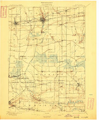
1897 Map of Medina
USGS Topo · Published 1909About this map
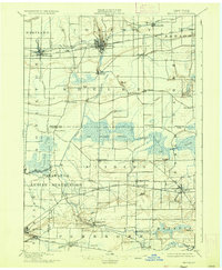
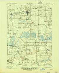
Medina serves as a major hub for commerce and transport in the late 1890s, where the Erie Canal and the New York Central and Hudson River R. R. converge. The landscape is defined by the contrast between industrial transport corridors and the expansive Oak Orchard Swamp, which dominates the central townships. To the south, the Tonawanda Indian Reservation spans the border of Niagara and Genesee counties, with Tonawanda Creek winding through its center. Small railroad hamlets and stations such as Shelby Basin, Eagle Harbor Sta., and Basom illustrate a rural economy built around the proximity of steel and water. This survey captures a moment when the Feeder Canal still played a vital role in local hydrology, connecting the Oak Orchard Creek system to the primary canal route.
Find a feature on this map
59 named features on this map. Tap any name to fly to it.
Don’t see what you’re looking for? This feature index may not catch every label — zoom into the map to look around manually.
Map Details
Editions of this 1897 Medina Map
7 editions found
Other maps of this area

1897 · Albion
USGS Topo · 1:62,500

1897 · Olcott
USGS Topo · 1:62,500

1897 · Medina
USGS Topo · 1:62,500

1897 · Lockport
USGS Topo · 1:62,500

1897 · Oak Orchard
USGS Topo · 1:62,500

1897 · Ridgeway
USGS Topo · 1:62,500

1899 · Niagara
USGS Topo · 1:125,000

1902 · Lockport
USGS Topo · 1:62,500

1904 · Batavia
USGS Topo · 1:62,500

1905 · Attica
USGS Topo · 1:62,500