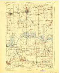
1897 Map of Medina
USGS Topo · Published 1927About this map
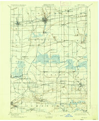
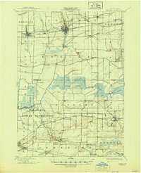
The Erie Canal serves as the primary industrial artery of this landscape, cutting through the northern settlements of Medina, Middleport, and Knowlesville. Parallel to this historic waterway, the New York Central and Hudson River railroad facilitates the heavy transport of the era, while the ancient Ridge Road skirts the northern boundary. South of these transit corridors, the terrain shifts into the expansive Oak Orchard Swamp, a massive wetland drained by Oak Orchard Creek that historically dictated the slow pace of agricultural expansion in Orleans and Genesee counties.
Find a feature on this map
55 named features on this map. Tap any name to fly to it.
Don’t see what you’re looking for? This feature index may not catch every label — zoom into the map to look around manually.
Map Details
Editions of this 1897 Medina Map
7 editions found
Other maps of this area

1897 · Albion
USGS Topo · 1:62,500

1897 · Olcott
USGS Topo · 1:62,500

1897 · Medina
USGS Topo · 1:62,500

1897 · Lockport
USGS Topo · 1:62,500

1897 · Oak Orchard
USGS Topo · 1:62,500

1897 · Ridgeway
USGS Topo · 1:62,500

1899 · Niagara
USGS Topo · 1:125,000

1902 · Lockport
USGS Topo · 1:62,500

1904 · Batavia
USGS Topo · 1:62,500

1905 · Attica
USGS Topo · 1:62,500