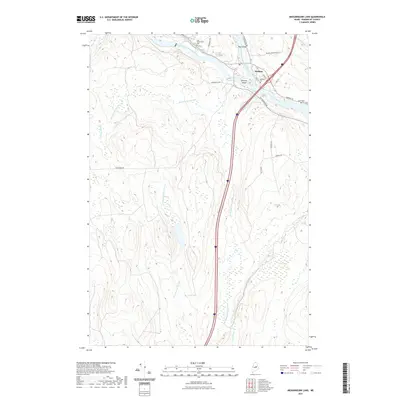
2021 Map of Medunkeunk Lake
USGS Topo · Published 2021About this map
The confluence of the West Branch Penobscot River and East Branch Penobscot River defines the landscape of Medway, Maine, in this 2021 survey. This geography created significant landmarks like Nicatou Island and Bay Island, which have long anchored local navigation and settlement patterns. The map highlights several local burying grounds, including Medway Cem, East Millinocket Cem, and the small Lynch Cem tucked away near Medway Road. Beyond the developed corridor of the Penobscot, the terrain turns to wetlands and tributary networks. Large-scale features such as Inman Bog and Carlisle Swamp dominate the eastern side, while the Medunkeunk Stream and Rockabema Stream drain the forested western interior. The contemporary road network, including the Nicatou Industrial Lane and Powersville Road, reflects the area's continued reliance on the river and timber access.
Find a feature on this map
31 named features on this map. Tap any name to fly to it.
Don’t see what you’re looking for? This feature index may not catch every label — zoom into the map to look around manually.
Map Details
Editions of this 2021 Medunkeunk Lake Map
This is the sole edition of this map. No revisions or reprints were ever made.
Other maps of this area

1920 · Winn
USGS Topo · 1:62,500

1940 · Mattawamkeag
USGS Topo · 1:62,500

1942 · Lincoln
USGS Topo · 1:62,500

1942 · Mattawamkeag
USGS Topo · 1:62,500

1951 · Millinocket
USGS Topo · 1:62,500

1954 · Millinocket
USGS Topo · 1:250,000

1957 · Lincoln
USGS Topo · 1:62,500

1958 · Millinocket
USGS Topo · 1:250,000

1960 · Millinocket
USGS Topo · 1:250,000
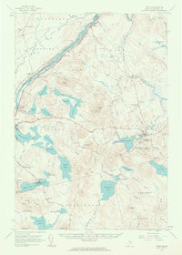
1960 · Winn
USGS Topo · 1:62,500