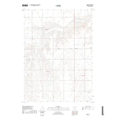
2017 Map of Meek
USGS Topo · Published 2017About this map
Eagle Creek winds through the dissected plains of Holt County, creating a complex drainage network that defines the local topography. This 2017 survey shows the sparse settlement patterns typical of the Nebraska Sandhills periphery, anchored by the small communities of Meek and Midway. The land is divided by a rigorous grid of section lines and rural routes, such as 891st Rd and Oil Co Rd, reflecting the enduring influence of the Public Land Survey System. Numerous smaller tributaries, including Honey Cr, Oak Cr, and Camp Cr, have carved deep draws into the landscape. This modern digital record allows researchers to trace the permanence of these remote settlements and their relationship to the seasonal waterways that sustain the region's agricultural and ranching heritage.
Find a feature on this map
21 named features on this map. Tap any name to fly to it.
Don’t see what you’re looking for? This feature index may not catch every label — zoom into the map to look around manually.
Map Details
Editions of this 2017 Meek Map
This is the sole edition of this map. No revisions or reprints were ever made.
Other maps of this area

1951 · Bristow
USGS Topo · 1:24,000

1952 · Spencer South
USGS Topo · 1:24,000

1952 · Butte SE
USGS Topo · 1:24,000

1954 · Atkinson SE
USGS Topo · 1:24,000

1954 · Meek NE
USGS Topo · 1:24,000

1954 · Opportunity
USGS Topo · 1:24,000

1954 · Meek SW
USGS Topo · 1:24,000

1954 · Meek
USGS Topo · 1:24,000

1954 · Atkinson NE
USGS Topo · 1:24,000

1955 · O'Neill
USGS Topo · 1:250,000