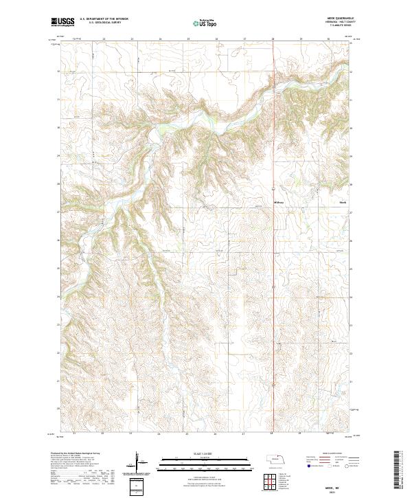
2021 Map of Meek
USGS Topo · Published 2021About this map
Midway and Meek stand as the primary focal points of this Holt County landscape, positioned along the transport corridor defined by Highway 281. The terrain is deeply sculpted by a complex network of waterways, most notably Eagle Creek, which winds through the northwestern and central reaches of the map. Smaller tributaries including Oak Cr, Honey Cr, and Camp Cr create a rugged topography of ridges and valleys typical of this portion of northern Nebraska. The section-line road network, including identifiers like 891 RD and 887th RD, reveals the persistent grid of rural land management. An interesting local detail is found at Oil Co Rd, suggesting historical industrial or commercial activity in an otherwise agrarian and hydrological landscape. Researchers will find the detailed drainage patterns of Blackbird Cr and the various township and range boundaries particularly useful for locating specific family tracts.
Find a feature on this map
29 named features on this map. Tap any name to fly to it.
Don’t see what you’re looking for? This feature index may not catch every label — zoom into the map to look around manually.
Map Details
Editions of this 2021 Meek Map
This is the sole edition of this map. No revisions or reprints were ever made.
Other maps of this area

1951 · Bristow
USGS Topo · 1:24,000

1952 · Spencer South
USGS Topo · 1:24,000

1952 · Butte SE
USGS Topo · 1:24,000

1954 · Atkinson SE
USGS Topo · 1:24,000

1954 · Meek NE
USGS Topo · 1:24,000

1954 · Opportunity
USGS Topo · 1:24,000

1954 · Meek SW
USGS Topo · 1:24,000

1954 · Meek
USGS Topo · 1:24,000

1954 · Atkinson NE
USGS Topo · 1:24,000

1955 · O'Neill
USGS Topo · 1:250,000