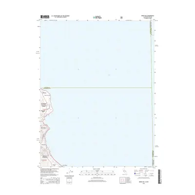
2015 Map of Meeks Bay
USGS Topo · Published 2015About this map
Lake Tahoe dominates the eastern half of this survey, with the shoreline of the Eldorado National Forest defining the western edge. The development pattern of the mid-2010s is visible along the narrow corridor between the water and the rising terrain, anchored by established settlements like Tahoma and Meeks Bay. Transportation is restricted to the primary artery of Emerald Bay Rd, which connects smaller residential enclaves such as Glenridge Park and Rubicon Properties. Local road networks like Scenic Dr and Rubicon Dr indicate how private properties and public access points like Lester Beach and Paradise Flat are integrated into the shorefront. The northern boundary reflects the jurisdictional transition from Placer County to El Dorado County just north of Sugar Pine Point.
Find a feature on this map
20 named features on this map. Tap any name to fly to it.
Don’t see what you’re looking for? This feature index may not catch every label — zoom into the map to look around manually.
Map Details
Editions of this 2015 Meeks Bay Map
This is the sole edition of this map. No revisions or reprints were ever made.
Other maps of this area

1889 · Pyramid Peak
USGS Topo · 1:125,000

1889 · Markleeville
USGS Topo · 1:125,000

1891 · Carson
USGS Topo · 1:125,000

1891 · Markleeville
USGS Topo · 1:125,000

1891 · Truckee
USGS Topo · 1:125,000

1891 · Pyramid Peak
USGS Topo · 1:125,000

1893 · Carson
USGS Topo · 1:125,000

1893 · Markleeville
USGS Topo · 1:125,000

1893 · Truckee
USGS Topo · 1:125,000

1895 · Pyramid Peak
USGS Topo · 1:125,000