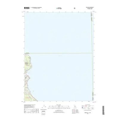
2018 Map of Meeks Bay
USGS Topo · Published 2018About this map
Lake Tahoe dominates the eastern half of this 2018 survey, defining the shoreline where the Sierra Nevada peaks meet the water. The map details the residential and recreational development along the western edge of the lake, specifically the settlements of Meeks Bay and Paradise Flat. These communities are situated along the winding route of Emerald Bay Rd, which serves as the primary artery connecting the various coves and points. Much of the land is preserved within the Ed Z'Berg Sugar Pine Point State Park and the Eldorado National Forest, indicating a landscape managed for public use and conservation.
Find a feature on this map
20 named features on this map. Tap any name to fly to it.
Don’t see what you’re looking for? This feature index may not catch every label — zoom into the map to look around manually.
Map Details
Editions of this 2018 Meeks Bay Map
This is the sole edition of this map. No revisions or reprints were ever made.
Other maps of this area

1889 · Pyramid Peak
USGS Topo · 1:125,000

1889 · Markleeville
USGS Topo · 1:125,000

1891 · Carson
USGS Topo · 1:125,000

1891 · Markleeville
USGS Topo · 1:125,000

1891 · Truckee
USGS Topo · 1:125,000

1891 · Pyramid Peak
USGS Topo · 1:125,000

1893 · Carson
USGS Topo · 1:125,000

1893 · Markleeville
USGS Topo · 1:125,000

1893 · Truckee
USGS Topo · 1:125,000

1895 · Pyramid Peak
USGS Topo · 1:125,000