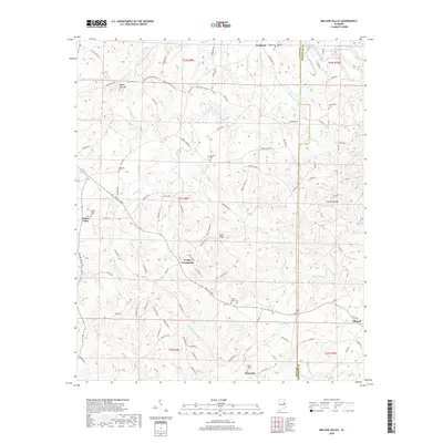
2018 Map of Mellow Valley
USGS Topo · Published 2018About this map
Cooley Crossroads and Mellow Valley anchor this rural stretch of the Alabama Piedmont near the Clay and Randolph county line. The landscape is defined by the high ground of White Oak Mtn and Evan Ridge, which separate a dense network of watercourses including Wesobulga Cr and Emuckfaw Cr. This modern survey reveals a community structure rooted in small settlements and family or church-affiliated burial grounds, such as Mount Gilead Cem and Mellow Valley Cem. The map traces the winding paths of local thoroughfares like Twilley Lands and Corinth Rd, which connect remote homesteads to established locales like Sikesville and Cragford. The distribution of these landmarks suggests a long history of agricultural life and decentralized local governance typical of eastern Alabama's upland regions.
Find a feature on this map
101 named features on this map. Tap any name to fly to it.
Don’t see what you’re looking for? This feature index may not catch every label — zoom into the map to look around manually.
Map Details
Editions of this 2018 Mellow Valley Map
This is the sole edition of this map. No revisions or reprints were ever made.
Other maps of this area

1891 · Ashland
USGS Topo · 1:125,000

1953 · Atlanta
USGS Topo · 1:250,000

1957 · Atlanta
USGS Topo · 1:250,000

1958 · Atlanta
USGS Topo · 1:250,000

1969 · New Site
USGS Topo · 1:24,000

1969 · Wadley North
USGS Topo · 1:24,000

1969 · Gibsonville
USGS Topo · 1:24,000
1969 · Daviston
USGS Topo · 1:24,000
1969 · Wadley South
USGS Topo · 1:24,000

1969 · Mellow Valley
USGS Topo · 1:24,000