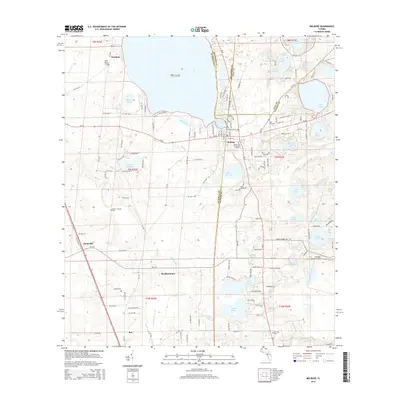
2015 Map of Melrose
USGS Topo · Published 2015About this map
Melrose sits at the junction of four counties, anchoring a landscape defined by an extensive network of freshwater lakes and rural hamlets in north-central Florida. This 2015 U.S. Geological Survey representation details the complex topography around Santa Fe Lake and Lake Melrose, where the boundaries of Alachua, Bradford, Clay, and Putnam counties converge. For genealogists and local historians, the sheet is particularly valuable for its precise location of burial grounds, including the historic Eliam Cem of Melrose Florida and the Nelson - Starke Cem to the west. Small settlements like Earleton, Beckhamtown, and Campville appear alongside more remote markers like Rex. The map captures the hydrological character of the region, from the winding path of Little Orange Creek to isolated bodies of water like Lake Rowan and Lake Suggs, providing a clear view of the area's modern rural development.
Find a feature on this map
133 named features on this map. Tap any name to fly to it.
Don’t see what you’re looking for? This feature index may not catch every label — zoom into the map to look around manually.
Map Details
Editions of this 2015 Melrose Map
This is the sole edition of this map. No revisions or reprints were ever made.
Other maps of this area

1915 · Interlachen
USGS Topo · 1:48,000

1916 · Interlachen
USGS Topo · 1:62,500

1938 · Hawthorn
USGS Topo · 1:48,000

1941 · Starke
USGS Topo · 1:62,500

1942 · Ates Creek
USGS Topo · 1:62,500

1943 · Hawthorn
USGS Topo · 1:62,500

1944 · Interlachen
USGS Topo · 1:62,500

1948 · Starke
USGS Topo · 1:50,000

1949 · Keuka
USGS Topo · 1:24,000

1949 · Gold Head Branch
USGS Topo · 1:24,000