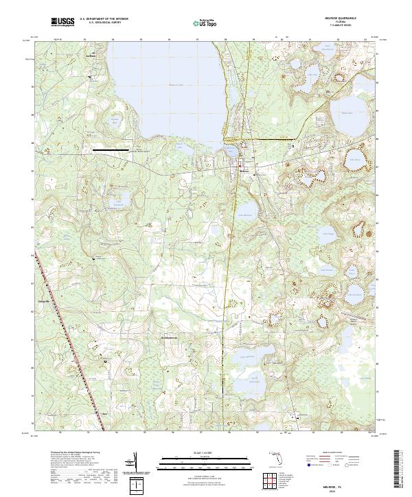
2024 Map of Melrose
USGS Topo · Published 2024About this map
Santa Fe Lake and Melrose Bay dominate the northern landscape of this region where four Florida counties—Alachua, Bradford, Putnam, and Clay—converge. The settlement of Melrose sits at this junction, serving as a gateway to a lake-strewn interior that includes Swan Lake, Lake Rosa, and Lake Winnott. The presence of numerous family and church burial grounds, such as Saint Johns Cem, Waters Cem, and the Nelson - Starke Cem, indicates a deeply rooted rural community structure. Transportation across this watery terrain is defined by local routes like Co Rd 219A and Co Rd 1474, connecting smaller points like Earleton and Beckhamtown. Land use varies from the private N Caledonia Ranch to specialized sites like The Flying Horseman Ranch Airport, illustrating the mixture of traditional ranching and modern aviation in the Florida lake district.
Find a feature on this map
116 named features on this map. Tap any name to fly to it.
Don’t see what you’re looking for? This feature index may not catch every label — zoom into the map to look around manually.
Map Details
Editions of this 2024 Melrose Map
This is the sole edition of this map. No revisions or reprints were ever made.
Other maps of this area

1915 · Interlachen
USGS Topo · 1:48,000

1916 · Interlachen
USGS Topo · 1:62,500

1938 · Hawthorn
USGS Topo · 1:48,000

1941 · Starke
USGS Topo · 1:62,500

1942 · Ates Creek
USGS Topo · 1:62,500

1943 · Hawthorn
USGS Topo · 1:62,500

1944 · Interlachen
USGS Topo · 1:62,500

1948 · Starke
USGS Topo · 1:50,000

1949 · Keuka
USGS Topo · 1:24,000

1949 · Gold Head Branch
USGS Topo · 1:24,000