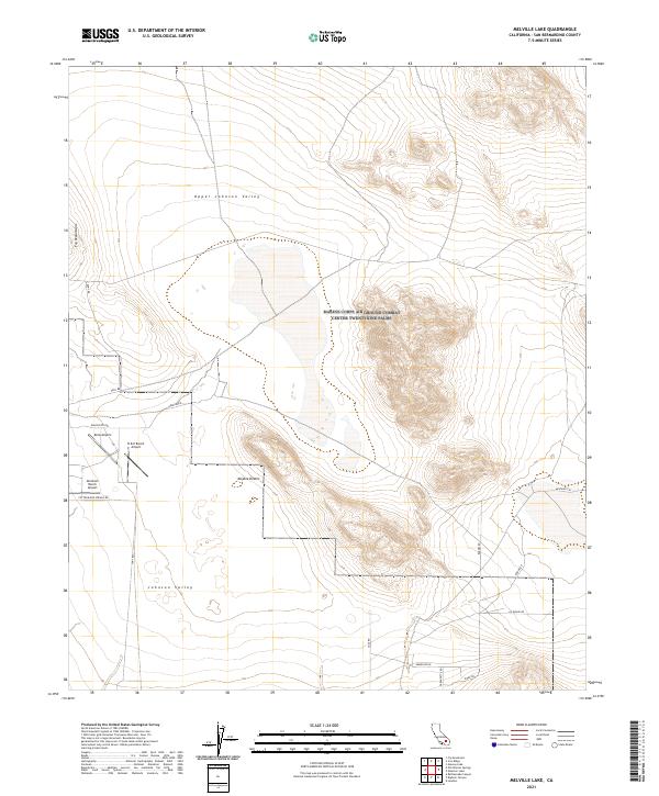
2021 Map of Melville Lake
USGS Topo · Published 2021About this map
The Mojave Desert terrain of San Bernardino County dominates this landscape, defined by the transition between Upper Johnson Valley and the lower Johnson Valley. This region is characterized by isolated aviation outposts and a network of desert tracks that reflect the area's remote ranching and recreational history. Private airstrips including B & E Ranch Airport, Abraham Ranch Airport, and Kelly Airport serve as localized hubs for transportation where the valley floor meets the base of the Fry Mountains. The movement across this arid basin is facilitated by named routes such as Pony Rd and Cottonwood Springs Rd, which connect scattered residential and agricultural parcels. The map illustrates the specialized land use in this part of the California desert, where wide valleys are interrupted by significant topographic rises and organized by the Public Land Survey System grids.
Find a feature on this map
28 named features on this map. Tap any name to fly to it.
Don’t see what you’re looking for? This feature index may not catch every label — zoom into the map to look around manually.
Map Details
Editions of this 2021 Melville Lake Map
This is the sole edition of this map. No revisions or reprints were ever made.
Other maps of this area

1901 · Southern California Sheet No. 1
USGS Topo · 1:250,000

1902 · San Gorgonio
USGS Topo · 1:125,000

1904 · Southern California Sheet No. 1
USGS Topo · 1:250,000

1953 · San Bernardino
USGS Topo · 1:250,000

1954 · Galway Lake
USGS Topo · 1:24,000

1954 · Emerson Lake
USGS Topo · 1:24,000

1955 · Old Woman Springs
USGS Topo · 1:62,500

1955 · Lavic
USGS Topo · 1:62,500

1955 · Emerson Lake
USGS Topo · 1:62,500

1955 · Rodman Mountains
USGS Topo · 1:62,500