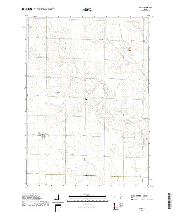
2022 Map of Melvin
USGS Topo · Published 2022About this map
The town of Melvin anchors the western edge of this agricultural landscape in northwestern Iowa, situated along the eastern rise of the Coteau des Prairies. This geographic plateau influences the local drainage patterns, with the Little Ocheyedan River and Ocheyedan River trending southeastward across the prairie. The map provides a clear look at the early 21st-century section line road network, where routes like Co Hwy A30 and Co Hwy A48 intersect a grid of gravel avenues. Centrally located within the township grid is the Baker Township Cem, a vital landmark for genealogists tracing pioneer families in this part of Osceola County. Further south, the headwaters of Waterman Cr begin to carve through the till plains, eventually crossing the border between Osceola and O'Brien counties.
Find a feature on this map
34 named features on this map. Tap any name to fly to it.
Don’t see what you’re looking for? This feature index may not catch every label — zoom into the map to look around manually.
Map Details
Editions of this 2022 Melvin Map
This is the sole edition of this map. No revisions or reprints were ever made.
Other maps of this area

1954 · Fairmont
USGS Topo · 1:250,000

1958 · Fairmont
USGS Topo · 1:250,000

1964 · Plessis
USGS Topo · 1:24,000

1964 · Sanborn
USGS Topo · 1:24,000

1970 · Hartley
USGS Topo · 1:24,000

1970 · May City
USGS Topo · 1:24,000

1970 · Harris
USGS Topo · 1:24,000

1972 · Ocheyedan
USGS Topo · 1:24,000

1972 · Cloverdale
USGS Topo · 1:24,000
1972 · Sibley East
USGS Topo · 1:24,000