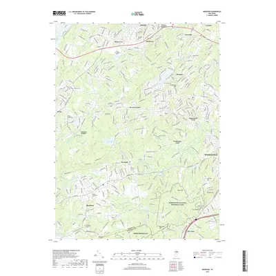
2019 Map of Mendham
USGS Topo · Published 2019About this map
Morristown National Historical Park anchors the southeastern landscape of this Morris County region, preserving the wooded terrain where Revolutionary War history is layered over modern residential growth. The area transitions from the busy municipal hubs of Dover and Morristown into the quieter, elevated reaches of Calais Mtn and Kemble Mtn. Significant water infrastructure, including the Clyde Potts Reservoir and Mendham Reservoir, highlights the long-standing management of local resources like India Brook and the Whippany River.
Find a feature on this map
72 named features on this map. Tap any name to fly to it.
Don’t see what you’re looking for? This feature index may not catch every label — zoom into the map to look around manually.
Map Details
Editions of this 2019 Mendham Map
This is the sole edition of this map. No revisions or reprints were ever made.
Other maps of this area

1888 · Plainfield
USGS Topo · 1:62,500

1888 · Morristown
USGS Topo · 1:62,500

1888 · Lake Hopatcong
USGS Topo · 1:62,500

1891 · Somerville
USGS Topo · 1:62,500

1893 · Plainfield
USGS Topo · 1:62,500

1893 · Somerville
USGS Topo · 1:62,500

1894 · Morristown
USGS Topo · 1:62,500

1894 · Lake Hopatcong
USGS Topo · 1:62,500

1898 · Lake Hopatcong
USGS Topo · 1:62,500

1898 · Morristown
USGS Topo · 1:62,500