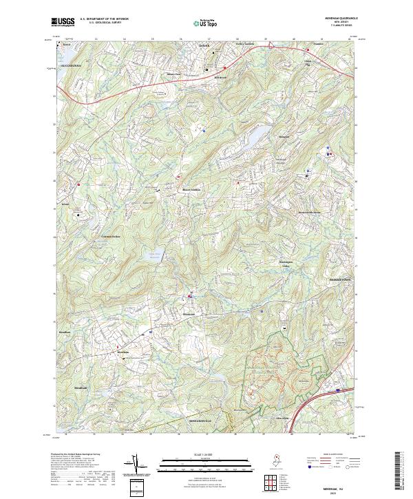
2023 Map of Mendham
USGS Topo · Published 2023About this map
Morristown National Historical Park anchors the southeastern landscape of this Morris County region, preserving significant grounds near Morristown. The area is defined by a complex drainage network where the North Branch Raritan River and Passaic River emerge from the high ground of Calais Mtn and Mine Mtn. Settlement patterns here reflect a transition from the established borough of Mendham and the village of Brookside to the higher elevations of Mount Freedom and Shongum. The map highlights several institutional and spiritual landmarks, including the Assumption College for Sisters and the Hilltop Presbyterian Cem. Regional water management is evident through the Clyde Potts Reservoir and Mendham Reservoir, which sit among the wooded ridges that separate these colonial-era communities.
Find a feature on this map
73 named features on this map. Tap any name to fly to it.
Don’t see what you’re looking for? This feature index may not catch every label — zoom into the map to look around manually.
Map Details
Editions of this 2023 Mendham Map
This is the sole edition of this map. No revisions or reprints were ever made.
Other maps of this area

1888 · Plainfield
USGS Topo · 1:62,500

1888 · Morristown
USGS Topo · 1:62,500

1888 · Lake Hopatcong
USGS Topo · 1:62,500

1891 · Somerville
USGS Topo · 1:62,500

1893 · Plainfield
USGS Topo · 1:62,500

1893 · Somerville
USGS Topo · 1:62,500

1894 · Morristown
USGS Topo · 1:62,500

1894 · Lake Hopatcong
USGS Topo · 1:62,500

1898 · Lake Hopatcong
USGS Topo · 1:62,500

1898 · Morristown
USGS Topo · 1:62,500