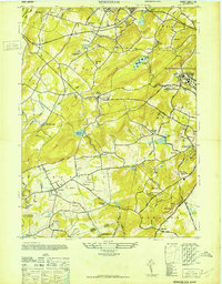
1947 Map of Mendham
USGS Topo · Published 1947About this map
Jockey Hollow Morristown National Historical Park occupies a significant portion of the southeastern terrain, reflecting the area's deep Revolutionary War connections. This post-war era landscape is characterized by a mix of institutional grounds and emerging suburban townships. Large-scale facilities such as the Greystone Park State Hospital for Insane and the Morris County Almshouse and Sanatorium dominate the eastern hills near the border of Parsippany-Troy Hills.
Find a feature on this map
56 named features on this map. Tap any name to fly to it.
Don’t see what you’re looking for? This feature index may not catch every label — zoom into the map to look around manually.
Map Details
Editions of this 1947 Mendham Map
This is the sole edition of this map. No revisions or reprints were ever made.
Other maps of this area

1888 · Plainfield
USGS Topo · 1:62,500

1888 · Morristown
USGS Topo · 1:62,500

1888 · Lake Hopatcong
USGS Topo · 1:62,500

1891 · Somerville
USGS Topo · 1:62,500

1893 · Plainfield
USGS Topo · 1:62,500

1893 · Somerville
USGS Topo · 1:62,500

1894 · Morristown
USGS Topo · 1:62,500

1894 · Lake Hopatcong
USGS Topo · 1:62,500

1898 · Lake Hopatcong
USGS Topo · 1:62,500

1898 · Morristown
USGS Topo · 1:62,500