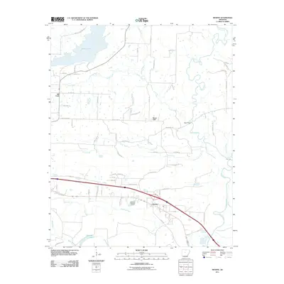
2011 Map of Menifee
USGS Topo · Published 2011About this map
Menifee sits at the heart of this Conway County landscape, where the flatlands of the Arkansas River valley meet a network of winding waterways. The northern reach is dominated by Brewer Lake, while the eastern border is defined by the serpentine path of Cadron Creek, a significant regional drainage that includes local landmarks like Slaty Ford and Shaw Bridge. The topography is marked by modest elevations such as Creben Hill Rd and Ragsdale Mountain Rd, providing a backdrop to the small rural communities of Mount Olive and Hill Creek. To the south, the terrain transitions into a wetter environment characterized by Miller Bayou and the oxbow formation of Old-River Lake. This survey illustrates the intricate intersection of water and roadway, showing how residential paths like Checkerboard Ln and Trails End Rd weave through a terrain shaped by Cypress Creek and Caney Creek.
Find a feature on this map
69 named features on this map. Tap any name to fly to it.
Don’t see what you’re looking for? This feature index may not catch every label — zoom into the map to look around manually.
Map Details
Editions of this 2011 Menifee Map
This is the sole edition of this map. No revisions or reprints were ever made.
Other maps of this area

1892 · Morrillton
USGS Topo · 1:125,000

1894 · Morrillton
USGS Topo · 1:125,000

1956 · Russellville
USGS Topo · 1:250,000

1961 · Menifee
USGS Topo · 1:24,000

1961 · Morrilton East
USGS Topo · 1:24,000

1961 · Houston
USGS Topo · 1:24,000

1961 · Gleason
USGS Topo · 1:24,000

1961 · Conway
USGS Topo · 1:24,000

1961 · Conway
USGS Topo · 1:62,500

1961 · Bee Branch
USGS Topo · 1:62,500