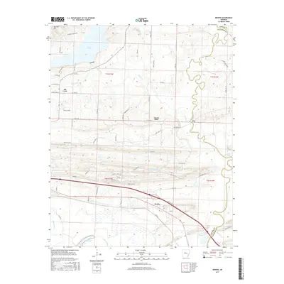
2017 Map of Menifee
USGS Topo · Published 2017About this map
The town of Menifee sits at the southern edge of this Arkansas landscape, where the transport corridor of Interstate 40 and Co Hwy 64 parallels the winding course of Cadron Creek. The map reveals a transition from the elevated terrain of Ragsdale Mtn in the northwest to the low-lying wetlands and oxbows of the Arkansas River floodplain. Significant water bodies like Brewer Lake and the aptly named Old River Lake dominate the hydrology, while the meandering path of Cadron Creek is punctuated by the historic crossing at Shaw Bridge. Rural settlements such as Mount Olive and Hill Creek are connected by a dense network of local roads like Mt Olive Rd and Hill Creek Dr, reflecting a residential pattern interspersed with drainage features like Little Caney Cr and Miller Bayou. This topography illustrates the complex drainage and historical land divisions between Conway and Faulkner counties.
Find a feature on this map
72 named features on this map. Tap any name to fly to it.
Don’t see what you’re looking for? This feature index may not catch every label — zoom into the map to look around manually.
Map Details
Editions of this 2017 Menifee Map
This is the sole edition of this map. No revisions or reprints were ever made.
Other maps of this area

1892 · Morrillton
USGS Topo · 1:125,000

1894 · Morrillton
USGS Topo · 1:125,000

1956 · Russellville
USGS Topo · 1:250,000

1961 · Menifee
USGS Topo · 1:24,000

1961 · Morrilton East
USGS Topo · 1:24,000

1961 · Houston
USGS Topo · 1:24,000

1961 · Gleason
USGS Topo · 1:24,000

1961 · Conway
USGS Topo · 1:24,000

1961 · Conway
USGS Topo · 1:62,500

1961 · Bee Branch
USGS Topo · 1:62,500