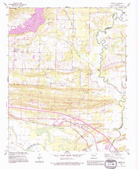
1991 Map of Menifee
USGS Topo · Published 1995About this map
Cadron Creek meanders along the Conway and Faulkner County line, defining a landscape of low-lying bayous and prominent ridges in the final decade of the twentieth century. The town of Menifee serves as a central hub near the southern edge, situated where modern infrastructure like Interchange 117 meets historical community pillars such as the County Training Sch and Zion Temple. To the north, the terrain rises toward Ragsdale Mtn and the Old Indian Reservation Boundary, which cuts across the northwest corner near Brewer Lake.
Find a feature on this map
28 named features on this map. Tap any name to fly to it.
Don’t see what you’re looking for? This feature index may not catch every label — zoom into the map to look around manually.
Map Details
Editions of this 1991 Menifee Map
This is the sole edition of this map. No revisions or reprints were ever made.
Other maps of this area

1892 · Morrillton
USGS Topo · 1:125,000

1894 · Morrillton
USGS Topo · 1:125,000

1956 · Russellville
USGS Topo · 1:250,000

1961 · Menifee
USGS Topo · 1:24,000

1961 · Morrilton East
USGS Topo · 1:24,000

1961 · Houston
USGS Topo · 1:24,000

1961 · Gleason
USGS Topo · 1:24,000

1961 · Conway
USGS Topo · 1:24,000

1961 · Conway
USGS Topo · 1:62,500

1961 · Bee Branch
USGS Topo · 1:62,500