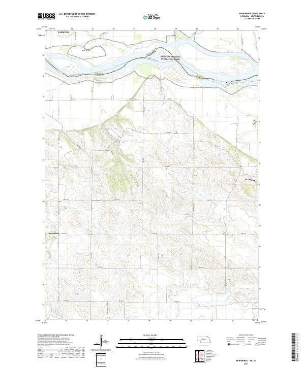
2021 Map of Menominee
USGS Topo · Published 2021About this map
The Missouri National Recreation River and Missouri Wild And Scenic River define the northern border of this landscape, separating Nebraska and South Dakota at the confluence with the James River. This 2021 survey shows a rural corridor preserved in its natural state, where the river braids around features like Rush Island. Just south of the bluffs, the small settlements of St. Helena and Menominee anchor a grid of township roads. The map reveals the transition from the river bottomlands to the rolling upland prairies of Cedar County, Nebraska, and Yankton County, South Dakota. While Yankton appears at the northwestern edge, the interior is characterized by agricultural section lines and drainage systems like Antelope Cr and Second Bow Cr. The presence of the Lower Missouri River Trl highlights the area's modern identity as a site for both conservation and recreation along the historic Missouri waterway.
Find a feature on this map
31 named features on this map. Tap any name to fly to it.
Don’t see what you’re looking for? This feature index may not catch every label — zoom into the map to look around manually.
Map Details
Editions of this 2021 Menominee Map
This is the sole edition of this map. No revisions or reprints were ever made.
Other maps of this area

1955 · Sioux City
USGS Topo · 1:250,000

1957 · Gayville
USGS Topo · 1:24,000

1957 · Mission Hill
USGS Topo · 1:24,000

1958 · Sioux City
USGS Topo · 1:250,000

1959 · Sioux City
USGS Topo · 1:250,000

1968 · St. Helena
USGS Topo · 1:24,000

1968 · Gavins Point Dam
USGS Topo · 1:24,000

1968 · Crofton
USGS Topo · 1:24,000

1968 · Wynot
USGS Topo · 1:24,000

1968 · Fordyce
USGS Topo · 1:24,000