
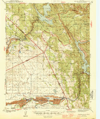
1944 Map of Merced Falls
USGS Topo · Published 1944About this map
Merced Falls and Snelling anchor the southern landscape along the Merced River, where dredging operations are evidenced by extensive Tailings deposits left in the river's wake. This 1942 survey captures the central California foothills during a period defined by massive water management projects and a declining but still visible mining industry. The map tracks the northern reaches of Lake McClure and the Don Pedro Reservoir on the Tuolumne River, illustrating how these reservoirs reshaped the terrain around Exchequer and La Grange.
Find a feature on this map
61 named features on this map. Tap any name to fly to it.
Don’t see what you’re looking for? This feature index may not catch every label — zoom into the map to look around manually.
Map Details
Editions of this 1944 Merced Falls Map
2 editions found
Other maps of this area

1893 · Sonora
USGS Topo · 1:125,000

1896 · Sonora
USGS Topo · 1:125,000

1897 · Sonora
USGS Topo · 1:125,000

1898 · Sonora
USGS Topo · 1:125,000

1913 · Dickenson
USGS Topo · 1:31,680

1915 · La Grange
USGS Topo · 1:24,000

1916 · Three Tree Flat
USGS Topo · 1:31,680

1916 · Hopeton
USGS Topo · 1:31,680

1916 · Cooperstown
USGS Topo · 1:31,680

1916 · Copperopolis
USGS Topo · 1:62,500