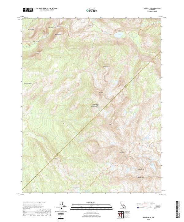
2021 Map of Merced Peak
USGS Topo · Published 2021About this map
Yosemite National Park dominates this high-altitude landscape where the Mariposa and Madera county boundary line cuts across the peaks of the Clark Range. This area is defined by the headwaters of the Merced Wild and Scenic River and a dense network of glacial basins and alpine lakes, including Adair Lake and Red Devil Lake. The map illustrates a wilderness largely defined by its natural barriers and the trails that traverse them, such as the legendary John Muir Trl near Little Yosemite Valley. Significant granite features like Bunnell Point and Quartzite Peak rise above the drainage systems of Illilouette Cr and Gray Cr. The concentration of named peaks—culminating at Merced Peak and Red Peak—suggests a landscape primarily accessed for recreation and research rather than settlement or industry.
Find a feature on this map
49 named features on this map. Tap any name to fly to it.
Don’t see what you’re looking for? This feature index may not catch every label — zoom into the map to look around manually.
Map Details
Editions of this 2021 Merced Peak Map
This is the sole edition of this map. No revisions or reprints were ever made.
Other maps of this area

1897 · Yosemite
USGS Topo · 1:125,000

1900 · Yosemite
USGS Topo · 1:125,000

1901 · Mt. Lyell
USGS Topo · 1:125,000

1903 · Yosemite
USGS Topo · 1:125,000

1909 · Yosemite
USGS Topo · 1:125,000

1947 · Mariposa
USGS Topo · 1:250,000

1948 · Mariposa
USGS Topo · 1:250,000

1953 · Merced Peak
USGS Topo · 1:62,500

1956 · Hetch Hetchy Reservoir
USGS Topo · 1:62,500

1956 · Tuolumne Meadows
USGS Topo · 1:62,500