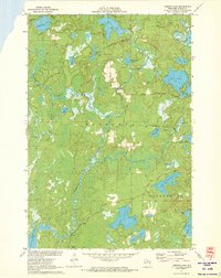
1971 Map of Mercer Lake
USGS Topo · Published 1973About this map
The Tomahawk River snakes through this Northwoods landscape, serving as the central artery for a region defined by its dense concentration of glacial lakes and wetlands. Within the townships of Minocqua and Hazelhurst, the terrain transitions between high timber and low marshlands, with the massive Willow Reservoir anchoring the southwestern corner. This early 1970s survey captures a moment of established recreational and industrial land use, where local routes like Manhardt Road and Camp 9 Nine Road provide access to the interior forests.
Find a feature on this map
37 named features on this map. Tap any name to fly to it.
Don’t see what you’re looking for? This feature index may not catch every label — zoom into the map to look around manually.
Map Details
Editions of this 1971 Mercer Lake Map
This is the sole edition of this map. No revisions or reprints were ever made.
Other maps of this area

1938 · Minocqua
USGS Topo · 1:48,000

1938 · Lac Du Flambeau
USGS Topo · 1:48,000

1939 · Lac Du Flambeau
USGS Topo · 1:48,000

1939 · Mc Cord
USGS Topo · 1:48,000

1939 · Cassian
USGS Topo · 1:48,000

1942 · Cassian
USGS Topo · 1:48,000

1946 · Minocqua
USGS Topo · 1:48,000

1946 · Lac Du Flambeau
USGS Topo · 1:48,000

1947 · Mc Cord
USGS Topo · 1:48,000

1949 · Minocqua
USGS Topo · 1:48,000