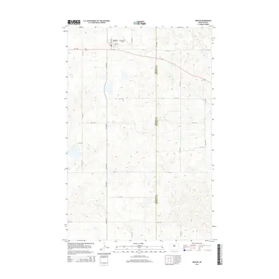
2014 Map of Mercer
USGS Topo · Published 2014About this map
Mercer serves as the primary hub of this North Dakota landscape, situated at the boundary of McLean and Sheridan counties. The town's grid is anchored by N Main St and E Regan St, reflecting the structured agricultural planning of the region. Just to the north, the Westerlind Airport facilitates local transit, while the surrounding terrain is defined by a dense concentration of prairie potholes and depressions. These distinctive geological features create a complex drainage pattern across the high plains, illustrating the post-glacial topography typical of the central part of the state. This 2014 edition captures the town's small-scale infrastructure and the intricate network of section-line roads that dominate the rural horizon.
Find a feature on this map
5 named features on this map. Tap any name to fly to it.
Don’t see what you’re looking for? This feature index may not catch every label — zoom into the map to look around manually.
Map Details
Editions of this 2014 Mercer Map
This is the sole edition of this map. No revisions or reprints were ever made.
Other maps of this area

1945 · Pelican Lake
USGS Topo · 1:62,500

1947 · Pelican Lake
USGS Topo · 1:62,500

1947 · Turtle Lake
USGS Topo · 1:62,500

1949 · Turtle Creek
USGS Topo · 1:62,500

1954 · McClusky
USGS Topo · 1:250,000

1958 · McClusky
USGS Topo · 1:250,000

1959 · Pickardville
USGS Topo · 1:24,000

1959 · Mercer
USGS Topo · 1:24,000

1959 · Mercer SW
USGS Topo · 1:24,000

1959 · Mercer SE
USGS Topo · 1:24,000