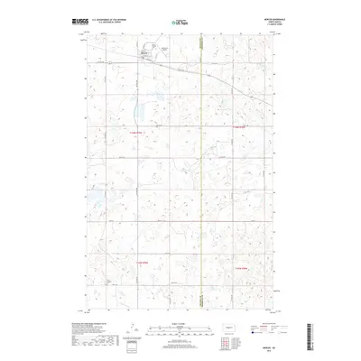
2018 Map of Mercer
USGS Topo · Published 2018About this map
The town of Mercer anchors this prairie landscape along the eastern edge of McLean County, where the agricultural grid meets the McLean Co Sheridan Co line. Established as a focal point for local transportation and trade, the town's original street plan is detailed with residential thoroughfares like Max St and Regan St, centered around the Railway E corridor. This 2018 survey reveals the persistent imprint of early 20th-century settlement patterns on the modern landscape, particularly evident in the preservation of the Mercer Hillside Cem north of town and the Zion Lutheran Cem to the south. Beyond the town limits, the terrain is defined by low-lying wetlands and the Westerlind Airport, reflecting the region's historical reliance on both traditional rail and private aviation for connectivity across the North Dakota plains.
Find a feature on this map
24 named features on this map. Tap any name to fly to it.
Don’t see what you’re looking for? This feature index may not catch every label — zoom into the map to look around manually.
Map Details
Editions of this 2018 Mercer Map
This is the sole edition of this map. No revisions or reprints were ever made.
Other maps of this area

1945 · Pelican Lake
USGS Topo · 1:62,500

1947 · Pelican Lake
USGS Topo · 1:62,500

1947 · Turtle Lake
USGS Topo · 1:62,500

1949 · Turtle Creek
USGS Topo · 1:62,500

1954 · McClusky
USGS Topo · 1:250,000

1958 · McClusky
USGS Topo · 1:250,000

1959 · Pickardville
USGS Topo · 1:24,000

1959 · Mercer
USGS Topo · 1:24,000

1959 · Mercer SW
USGS Topo · 1:24,000

1959 · Mercer SE
USGS Topo · 1:24,000