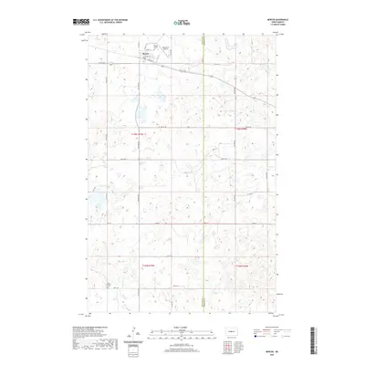
2020 Map of Mercer
USGS Topo · Published 2020About this map
Mercer serves as the central hub of this agricultural landscape situated along the border of McLean and Sheridan Counties. The town's grid is clearly defined by historical thoroughfares like Main St, North St, and Railway E, reflecting the traditional importance of rail-aligned commerce in the Great Plains. Just north of the main settlement lies the Mercer Hillside Cem and the Westerlind Airport, while the surrounding sections are marked by numerous small wetlands and basins typical of the region's prairie pothole topography. Further south, the rural landscape is anchored by the Zion Lutheran Cem, which stands as a quiet marker of the community's ancestral heritage and early religious foundations.
Find a feature on this map
20 named features on this map. Tap any name to fly to it.
Don’t see what you’re looking for? This feature index may not catch every label — zoom into the map to look around manually.
Map Details
Editions of this 2020 Mercer Map
This is the sole edition of this map. No revisions or reprints were ever made.
Other maps of this area

1945 · Pelican Lake
USGS Topo · 1:62,500

1947 · Pelican Lake
USGS Topo · 1:62,500

1947 · Turtle Lake
USGS Topo · 1:62,500

1949 · Turtle Creek
USGS Topo · 1:62,500

1954 · McClusky
USGS Topo · 1:250,000

1958 · McClusky
USGS Topo · 1:250,000

1959 · Pickardville
USGS Topo · 1:24,000

1959 · Mercer
USGS Topo · 1:24,000

1959 · Mercer SW
USGS Topo · 1:24,000

1959 · Mercer SE
USGS Topo · 1:24,000