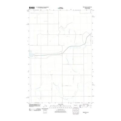
2011 Map of Mercer SE
USGS Topo · Published 2011About this map
McClusky Canal cuts a prominent horizontal path through this section of Burleigh County, representing a major piece of regional water infrastructure. The landscape is defined by the winding course of Painted Woods Creek, which meanders through the southern half of the quadrangle. This 2011 survey illustrates a strictly organized section-line road network, where routes like 118th St NE and Center Ave S facilitate access across the open plains. The map provides a clear look at the intersection of natural drainage and modern irrigation engineering, capturing the rural character of the area just south of Mercer before further development or land-use changes altered these traditional field boundaries.
Find a feature on this map
21 named features on this map. Tap any name to fly to it.
Don’t see what you’re looking for? This feature index may not catch every label — zoom into the map to look around manually.
Map Details
Editions of this 2011 Mercer SE Map
This is the sole edition of this map. No revisions or reprints were ever made.
Other maps of this area

1954 · McClusky
USGS Topo · 1:250,000

1958 · McClusky
USGS Topo · 1:250,000

1959 · Pickardville
USGS Topo · 1:24,000

1959 · Mercer
USGS Topo · 1:24,000

1959 · Mercer SW
USGS Topo · 1:24,000

1959 · Mercer SE
USGS Topo · 1:24,000

1959 · McClusky
USGS Topo · 1:24,000

1960 · Horse Lake
USGS Topo · 1:24,000
1979 · Regan
USGS Topo · 1:24,000

1979 · Canfield Lake
USGS Topo · 1:24,000