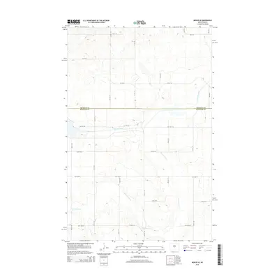
2014 Map of Mercer SE
USGS Topo · Published 2014About this map
Sheridan Co and Burleigh Co meet along a straight east-west boundary line in this section of the North Dakota plains. The landscape is defined by the significant engineering of the McClusky Canal, which cuts across the prairie terrain, and the meandering course of Painted Woods Cr as it winds through the southern half of the quadrangle. The area is structured by a rigorous grid of section-line roads, including 461st Ave NE and 409th Ave NE, illustrating the persistent influence of the Public Land Survey System on the rural North Dakota landscape. This 2014 survey documents the modern state of these water management and agricultural transport networks in a largely unpopulated portion of the state.
Find a feature on this map
13 named features on this map. Tap any name to fly to it.
Don’t see what you’re looking for? This feature index may not catch every label — zoom into the map to look around manually.
Map Details
Editions of this 2014 Mercer SE Map
This is the sole edition of this map. No revisions or reprints were ever made.
Other maps of this area

1954 · McClusky
USGS Topo · 1:250,000

1958 · McClusky
USGS Topo · 1:250,000

1959 · Pickardville
USGS Topo · 1:24,000

1959 · Mercer
USGS Topo · 1:24,000

1959 · Mercer SW
USGS Topo · 1:24,000

1959 · Mercer SE
USGS Topo · 1:24,000

1959 · McClusky
USGS Topo · 1:24,000

1960 · Horse Lake
USGS Topo · 1:24,000
1979 · Regan
USGS Topo · 1:24,000

1979 · Canfield Lake
USGS Topo · 1:24,000