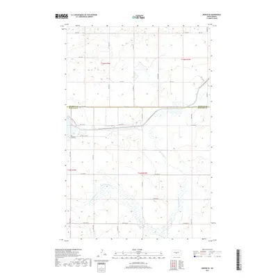
2018 Map of Mercer SE
USGS Topo · Published 2018About this map
The rolling plains of the North Dakota interior meet significant water engineering in this survey of the region. The McClusky Canal cuts a distinct path through the landscape, designed to divert water from Lake Sakakawea as part of the Garrison Diversion Unit. Nearby, the N Country National Scenic Trail winds across the boundary between Sheridan and Burleigh Counties, providing a recreational artery through the prairie.
Find a feature on this map
24 named features on this map. Tap any name to fly to it.
Don’t see what you’re looking for? This feature index may not catch every label — zoom into the map to look around manually.
Map Details
Editions of this 2018 Mercer SE Map
This is the sole edition of this map. No revisions or reprints were ever made.
Other maps of this area

1954 · McClusky
USGS Topo · 1:250,000

1958 · McClusky
USGS Topo · 1:250,000

1959 · Pickardville
USGS Topo · 1:24,000

1959 · Mercer
USGS Topo · 1:24,000

1959 · Mercer SW
USGS Topo · 1:24,000

1959 · Mercer SE
USGS Topo · 1:24,000

1959 · McClusky
USGS Topo · 1:24,000

1960 · Horse Lake
USGS Topo · 1:24,000
1979 · Regan
USGS Topo · 1:24,000

1979 · Canfield Lake
USGS Topo · 1:24,000