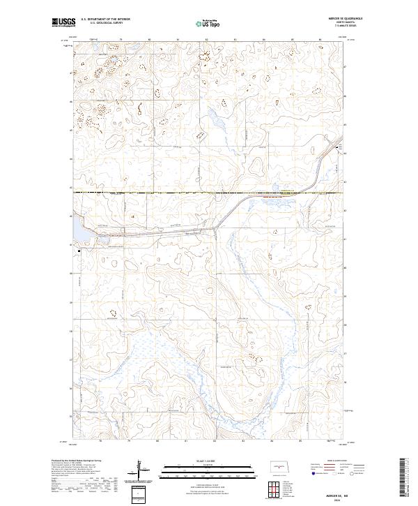
2024 Map of Mercer SE
USGS Topo · Published 2024About this map
Sheridan County Waterfowl Production Area dominates the northern reaches of this Missouri Coteau landscape, where the prairie is defined by numerous small wetlands and kettle ponds. The boundary between Sheridan County and Burleigh County bisects the terrain, marked by a shift in the section-line road grid near the McClusky Canal. This massive water-diversion project cuts a distinct path through the topography, followed closely by the North Country National Scenic Trl. To the south, the meandering Painted Woods Creek drains through a broad, marshy valley, contrasting with the engineered precision of the canal. Genealogists may note the Last Rest Cem located in the northeast corner, one of the few designated landmarks in this predominantly agricultural and conservation-focused region.
Find a feature on this map
21 named features on this map. Tap any name to fly to it.
Don’t see what you’re looking for? This feature index may not catch every label — zoom into the map to look around manually.
Map Details
Editions of this 2024 Mercer SE Map
This is the sole edition of this map. No revisions or reprints were ever made.
Other maps of this area

1954 · McClusky
USGS Topo · 1:250,000

1958 · McClusky
USGS Topo · 1:250,000

1959 · Pickardville
USGS Topo · 1:24,000

1959 · Mercer
USGS Topo · 1:24,000

1959 · Mercer SW
USGS Topo · 1:24,000

1959 · Mercer SE
USGS Topo · 1:24,000

1959 · McClusky
USGS Topo · 1:24,000

1960 · Horse Lake
USGS Topo · 1:24,000
1979 · Regan
USGS Topo · 1:24,000

1979 · Canfield Lake
USGS Topo · 1:24,000