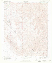
1969 Map of Mercey Hot Springs
USGS Topo · Published 1972About this map
Mercey Hot Springs serves as the focal point for this 1969 topographic study, situated where the Little Panoche Valley meets the rising terrain of the Panoche Hills. The landscape is defined by its remote infrastructure, including a Landing Strip and a Radio Facility, illustrating the mid-century development of this interior California region. Water sources like Little Panoche Creek and several unnamed Spring labels highlight the critical importance of hydrology in the arid foothills near the Fresno and San Benito county line. Topographically, the map traces the distinct elevation of Glauco-phane Ridge and the descent into Indian Valley. A network of Jeep Trails and an Access Road navigate the complex drainages of Capita Canyon and Las Aguilas Creek, providing a record of land use and transit during the late 1960s.
Find a feature on this map
18 named features on this map. Tap any name to fly to it.
Don’t see what you’re looking for? This feature index may not catch every label — zoom into the map to look around manually.
Map Details
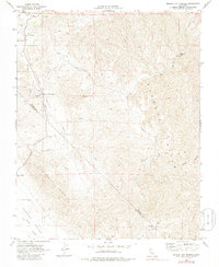
Editions of this 1969 Mercey Hot Springs Map
2 editions found
Other maps of this area

1913 · Panoche
USGS Topo · 1:125,000

1921 · Laguna Seca Ranch
USGS Topo · 1:31,680

1921 · Tierra Loma School
USGS Topo · 1:31,680

1923 · Laguna Seca Ranch
USGS Topo · 1:31,680

1923 · Tierra Loma School
USGS Topo · 1:31,680

1923 · Little Panoche
USGS Topo · 1:31,680

1943 · Ortigalita Peak
USGS Topo · 1:62,500

1944 · Panoche Valley
USGS Topo · 1:62,500

1948 · Santa Cruz
USGS Topo · 1:250,000

1955 · Santa Cruz
USGS Topo · 1:250,000