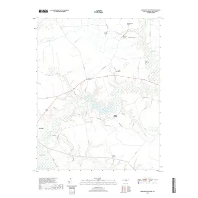
2019 Map of Merchants Millpond
USGS Topo · Published 2019About this map
Merchants Millpond and its surrounding wetlands form the center of this Gates County landscape, where the waters of Bennetts Creek and Flat Branch flow through a network of cypress-dominated basins. This 2019 survey documents a region defined by its swamps, including Honey Pot Swamp and Duke Swamp, punctuated by small rural crossroads and family holdings. For genealogists and local historians, the map is remarkably dense with specific family burial grounds, such as the Linwood Taylor Cem, Samuel Harrell Family Cem, and Rountree - Brown Family Cem. These sites, along with the Middle Swamp Baptist Church Cem, reflect generations of settlement patterns along the ridges between the wetlands. The transition from agricultural fields to water is clear near Eason Crossroads and Gatesville, while the Middle Swamp Hunt Club points to the long-standing recreational and land-use traditions in these coastal plains.
Find a feature on this map
49 named features on this map. Tap any name to fly to it.
Don’t see what you’re looking for? This feature index may not catch every label — zoom into the map to look around manually.
Map Details
Editions of this 2019 Merchants Millpond Map
This is the sole edition of this map. No revisions or reprints were ever made.
Other maps of this area

1906 · Beckford
USGS Topo · 1:48,000

1907 · Beckford
USGS Topo · 1:62,500

1908 · Winton
USGS Topo · 1:62,500

1919 · Suffolk
USGS Topo · 1:62,500

1920 · Holland
USGS Topo · 1:62,500

1940 · Beckford
USGS Topo · 1:62,500

1943 · Holland
USGS Topo · 1:62,500

1953 · Norfolk
USGS Topo · 1:250,000

1954 · Corapeake
USGS Topo · 1:24,000
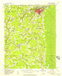
1954 · Suffolk
USGS Topo · 1:62,500