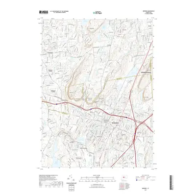
2021 Map of Meriden
USGS Topo · Published 2021About this map
The Hanging Hills and Metacomet Ridge dominate the central landscape of this 2021 study, framing the urban expansion of Meriden. The map documents a dense network of civic and religious history, notably through a significant concentration of cemeteries including the Meriden Hebrew Cem, Saint Patricks Cem, and Broad Street Cem. These sites, alongside landmarks like the New Haven Judicial District Superior Court at Meriden, illustrate the long-standing community structure of the region.
Find a feature on this map
79 named features on this map. Tap any name to fly to it.
Don’t see what you’re looking for? This feature index may not catch every label — zoom into the map to look around manually.
Map Details
Editions of this 2021 Meriden Map
This is the sole edition of this map. No revisions or reprints were ever made.
Other maps of this area

1892 · New Haven
USGS Topo · 1:62,500

1892 · Meriden
USGS Topo · 1:62,500

1893 · Guilford
USGS Topo · 1:62,500

1893 · Middletown
USGS Topo · 1:62,500

1893 · Meriden
USGS Topo · 1:62,500

1906 · Farmington
USGS Topo · 1:125,000

1921 · New Haven
USGS Topo · 1:62,500

1928 · Cromwell
USGS Topo · 1:24,000

1943 · Durham
USGS Topo · 1:25,000

1944 · Hartford South
USGS Topo · 1:31,680