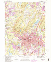
2024 Map of Meriden
USGS Topo · Published 2024About this map
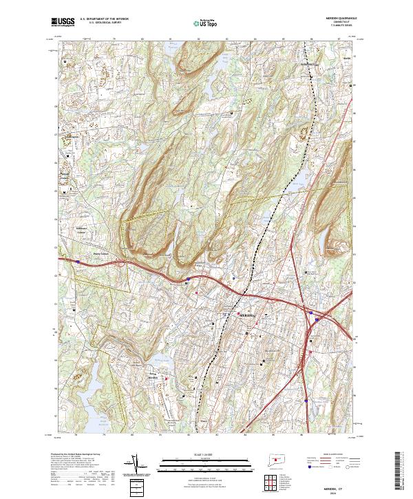
Meriden and its surrounding valleys are defined by the dramatic north-south ridges of the Metacomet Ridge, including the prominent heights of the Hanging Hills and Lamentation Mtn. This landscape is deeply etched by a network of waterways like the Quinnipiac River and Harbor Brook, which historically drove the region's industrial development. The map reveals a dense corridor of civic and religious life, particularly through its numerous denominational cemeteries such as Saint Thomas Cem and the Meriden Hebrew Cem. Settlement patterns follow the topography, with established centers like South Meriden, Kensington, and Southington clustered in the lowlands between the traprock ridges. Transport infrastructure is a primary feature, shown through the central Amtrak rail line and the heavy footprint of the Meriden Waterbury Tpke and Berlin Tpke.
Find a feature on this map
106 named features on this map. Tap any name to fly to it.
Don’t see what you’re looking for? This feature index may not catch every label — zoom into the map to look around manually.
Map Details
Editions of this 2024 Meriden Map
This is the sole edition of this map. No revisions or reprints were ever made.
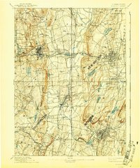
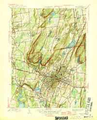
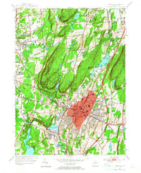
Historical Maps of Pratts Corner Through Time
6 maps found