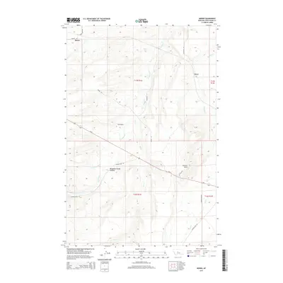
2014 Map of Merino
USGS Topo · Published 2014About this map
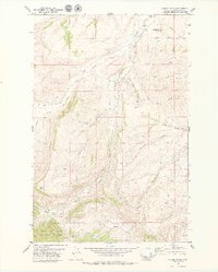
Merino and Dover anchor this high plains landscape in central Montana, where the terrain is defined by a network of seasonal watercourses and prominent landforms. The Surprise Creek Colony stands as a focal point of communal agricultural life, situated south of the namesake Surprise Cr. This drainage system, which includes the N Fork Surprise Cr and Sun Cr, feeds into the regional topography alongside other notable waterways like Meadow Cr and Wolf Cr. The presence of Fox Coulee and the distinct elevation of Antelope Butte illustrate the erosion-carved character of the Judith Basin. Modern infrastructure is represented by Us-87, which cuts diagonally through the southern half of the quadrangle, intersecting local routes such as Surprise Creek Rd and Broken Arrow Rd. The map also documents ranching-era legacy through specifically named thoroughfares like Merino Rd and Merino Bench Rd.
Find a feature on this map
22 named features on this map. Tap any name to fly to it.
Don’t see what you’re looking for? This feature index may not catch every label — zoom into the map to look around manually.
Map Details
Editions of this 2014 Merino Map
This is the sole edition of this map. No revisions or reprints were ever made.
Other maps of this area

1890 · Fort Benton
USGS Topo · 1:250,000

1892 · Fort Benton
USGS Topo · 1:250,000

1897 · Fort Benton
USGS Topo · 1:250,000

1954 · Great Falls
USGS Topo · 1:250,000

1957 · Great Falls
USGS Topo · 1:250,000

1978 · Leiberg Coulee
USGS Topo · 1:24,000
1978 · Windham
USGS Topo · 1:24,000
1978 · Merino
USGS Topo · 1:24,000
1978 · Stanford
USGS Topo · 1:24,000
1979 · Cayuse Basin
USGS Topo · 1:24,000