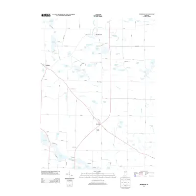
2013 Map of Merriam
USGS Topo · Published 2013About this map
Port Mitchell and the small settlements of Merriam and Burr Oak anchor this landscape of the upper Elkhart River watershed. This region is defined by an intricate network of glacial lakes and drainage systems, including the South Branch Elkhart River and Steffy Ditch. The presence of Stangland Airport and Shaffer Airport highlights the rural aviation infrastructure common in this part of Indiana. Numerous family-named roads and sites, such as Riddle Farms and N Long Lake Rd, suggest a long history of local land ownership. The map shows a transition from the water-rich northern sections near Port Mitchell Lake and Kuhns Lake to the agricultural reaches surrounding Gandy Ditch and Mud Run. Local history enthusiasts can trace the old road alignments and the numerous lake shores like Wolf Lake and Marl Lake that have shaped the development of these communities.
Find a feature on this map
86 named features on this map. Tap any name to fly to it.
Don’t see what you’re looking for? This feature index may not catch every label — zoom into the map to look around manually.
Map Details
Editions of this 2013 Merriam Map
This is the sole edition of this map. No revisions or reprints were ever made.
Other maps of this area

1951 · Ormas
USGS Topo · 1:24,000

1951 · Merriam
USGS Topo · 1:24,000

1953 · Fort Wayne
USGS Topo · 1:250,000

1955 · Columbia City
USGS Topo · 1:24,000

1955 · Ege
USGS Topo · 1:24,000

1955 · Kendallville
USGS Topo · 1:24,000

1956 · Fort Wayne
USGS Topo · 1:250,000

1956 · Ligonier
USGS Topo · 1:24,000

1956 · Lorane
USGS Topo · 1:24,000

1956 · Albion
USGS Topo · 1:24,000