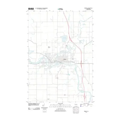
2010 Map of Merrill
USGS Topo · Published 2010About this map
The confluence of the Wisconsin River and the Prairie River anchors this 2010 survey of the city of Merrill. The local landscape is defined by its relationship with water and industry, as evidenced by the Merrill 1874C118 Dam and the various reservoirs and backwaters like Alexander Lake and Pesabic Lake. The street grid of the city center clusters near the Merrill Post Office, transitioning into a network of outlying roads that cross smaller tributaries such as Joe Snow Creek and Black Alder Creek. To the north and south, the map details municipal and community infrastructure including the Merrill Municipal Airport and multiple burial grounds like Merrill Cemetery and Saint John Cemetery. This geographic record captures the developed footprint of the community alongside the wooded creek basins of central Wisconsin.
Find a feature on this map
18 named features on this map. Tap any name to fly to it.
Don’t see what you’re looking for? This feature index may not catch every label — zoom into the map to look around manually.
Map Details
Editions of this 2010 Merrill Map
This is the sole edition of this map. No revisions or reprints were ever made.
Other maps of this area

1899 · Wausau
USGS Topo · 1:125,000

1902 · Wausau
USGS Topo · 1:125,000

1902 · Marathon
USGS Topo · 1:125,000

1950 · Tomahawk
USGS Topo · 1:48,000

1950 · Spirit Falls
USGS Topo · 1:48,000

1951 · Merrill
USGS Topo · 1:48,000

1951 · Hamburg
USGS Topo · 1:48,000

1952 · Spirit Falls
USGS Topo · 1:48,000

1952 · Tomahawk
USGS Topo · 1:48,000

1954 · Iron Mountain
USGS Topo · 1:250,000