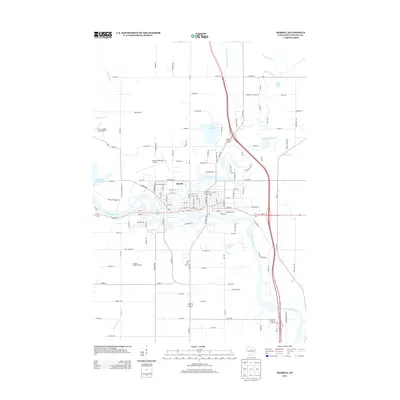
2013 Map of Merrill
USGS Topo · Published 2013About this map
The Wisconsin River and Prairie River converge at the city of Merrill, anchoring this north-central Wisconsin landscape. The 2013 survey illustrates the developed street grid of the town center, which transitions into rural orchards and recreational water bodies. North of the city, Lake Pesobic and Gospel Lake dot the terrain, while the western edge is dominated by the Alexander Flowage 1520. This area is characterized by its aviation and agricultural facilities, including the Merrill Municipal Airport and Helene's Hilltop Orchard. Smaller watercourses like Joe Snow Cr and Devil Creek feed into the larger river systems, defining the drainage patterns through Lincoln County. The map also traces the path of Wi-107 and numerous county highways that connect the outlying rural homes and timber tracts to the municipal core.
Find a feature on this map
129 named features on this map. Tap any name to fly to it.
Don’t see what you’re looking for? This feature index may not catch every label — zoom into the map to look around manually.
Map Details
Editions of this 2013 Merrill Map
This is the sole edition of this map. No revisions or reprints were ever made.
Other maps of this area

1899 · Wausau
USGS Topo · 1:125,000

1902 · Wausau
USGS Topo · 1:125,000

1902 · Marathon
USGS Topo · 1:125,000

1950 · Tomahawk
USGS Topo · 1:48,000

1950 · Spirit Falls
USGS Topo · 1:48,000

1951 · Merrill
USGS Topo · 1:48,000

1951 · Hamburg
USGS Topo · 1:48,000

1952 · Spirit Falls
USGS Topo · 1:48,000

1952 · Tomahawk
USGS Topo · 1:48,000

1954 · Iron Mountain
USGS Topo · 1:250,000