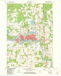
1982 Map of Merrill
USGS Topo · Published 1983About this map
The Wisconsin River defines the physical and economic heart of Merrill, flowing past industrial sites, municipal landmarks like the Courthouse, and through the wooded expanse of Council Grounds State Park. This 1980s landscape shows a city deeply integrated with its waterways, where the Ward Mill Pond and Alexander Lake neighbor established residential streets and educational hubs like Jefferson Sch and Lincoln Sch. The built environment is dense along the river's bend, while the northern and southern reaches of the township transition into a mix of small farms and wooded tracts.
Find a feature on this map
62 named features on this map. Tap any name to fly to it.
Don’t see what you’re looking for? This feature index may not catch every label — zoom into the map to look around manually.
Map Details
Editions of this 1982 Merrill Map
This is the sole edition of this map. No revisions or reprints were ever made.
Other maps of this area

1899 · Wausau
USGS Topo · 1:125,000

1902 · Wausau
USGS Topo · 1:125,000

1902 · Marathon
USGS Topo · 1:125,000

1950 · Tomahawk
USGS Topo · 1:48,000

1950 · Spirit Falls
USGS Topo · 1:48,000

1951 · Merrill
USGS Topo · 1:48,000

1951 · Hamburg
USGS Topo · 1:48,000

1952 · Spirit Falls
USGS Topo · 1:48,000

1952 · Tomahawk
USGS Topo · 1:48,000

1954 · Iron Mountain
USGS Topo · 1:250,000