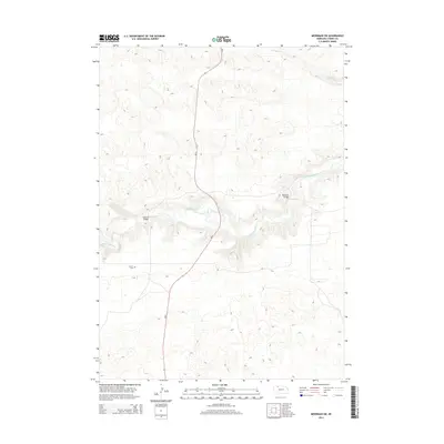
2014 Map of Merriman SW
USGS Topo · Published 2014About this map
The Niobrara River carves a distinct valley through this section of the Nebraska Sandhills, providing a stark geographic contrast to the surrounding terrain. Two primary river crossings facilitate movement through this sparsely populated landscape: Madison Bridge and Rockford Bridge, both situated along the winding watercourse. The presence of Center Cem indicates the historical center of the local community, serving as a vital touchstone for genealogists and local historians tracing families in this part of Cherry County. Ne 61 serves as the primary north-south artery, cutting through the sandhills and intersecting the river valley, while Leander Cr drains the northern reaches of the quadrangle.
Find a feature on this map
6 named features on this map. Tap any name to fly to it.
Don’t see what you’re looking for? This feature index may not catch every label — zoom into the map to look around manually.
Map Details
Editions of this 2014 Merriman SW Map
This is the sole edition of this map. No revisions or reprints were ever made.
Other maps of this area

1950 · Irwin
USGS Topo · 1:62,500

1951 · Irwin
USGS Topo · 1:62,500

1951 · Gypsy Valley
USGS Topo · 1:62,500

1951 · Merriman
USGS Topo · 1:62,500

1951 · Merriman 4
USGS Topo · 1:62,500

1957 · Valentine
USGS Topo · 1:250,000

1959 · Valentine
USGS Topo · 1:250,000

1985 · Cody
USGS Topo · 1:100,000
1990 · Merriman NE
USGS Topo · 1:24,000
1990 · Merriman
USGS Topo · 1:24,000