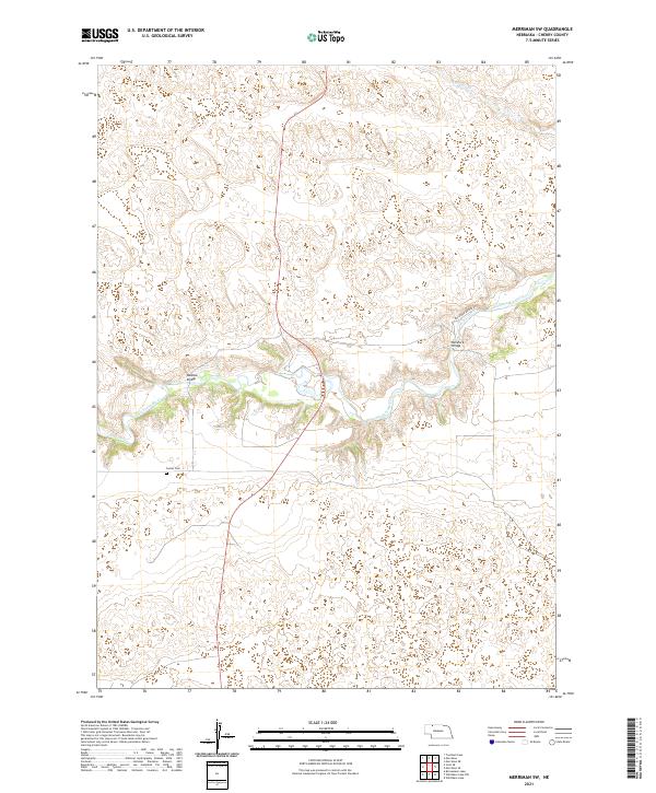
2021 Map of Merriman SW
USGS Topo · Published 2021About this map
The Niobrara River carves a deep path through the Nebraska Sandhills in this Cherry County landscape. The river corridor is the central focus of the area, defined by its steep banks and winding course that contrasts sharply with the surrounding uplands. Local transportation patterns are evident through the placement of Madison Bridge and Rockford Bridge, which provide critical crossing points in an otherwise sparsely developed region. Near the river's south bank, the Center Cem serves as a small but significant landmark for genealogical research. The northern reach of the map is drained by the smaller Leander Cr, which feeds into the Niobrara. Much of the infrastructure is concentrated along Rockford Bridge Rd, showing how the local road network was designed to navigate the river's complex topography in the early twenty-first century.
Find a feature on this map
12 named features on this map. Tap any name to fly to it.
Don’t see what you’re looking for? This feature index may not catch every label — zoom into the map to look around manually.
Map Details
Editions of this 2021 Merriman SW Map
This is the sole edition of this map. No revisions or reprints were ever made.
Other maps of this area

1950 · Irwin
USGS Topo · 1:62,500

1951 · Irwin
USGS Topo · 1:62,500

1951 · Gypsy Valley
USGS Topo · 1:62,500

1951 · Merriman
USGS Topo · 1:62,500

1951 · Merriman 4
USGS Topo · 1:62,500

1957 · Valentine
USGS Topo · 1:250,000

1959 · Valentine
USGS Topo · 1:250,000

1985 · Cody
USGS Topo · 1:100,000
1990 · Merriman NE
USGS Topo · 1:24,000
1990 · Merriman
USGS Topo · 1:24,000