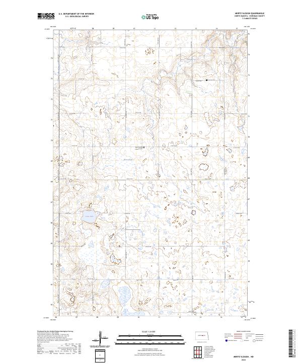
2024 Map of Mertz Slough
USGS Topo · Published 2024About this map
Mertz Slough and Jones Lake dominate the central prairie of this Sheridan County landscape, where the terrain is defined by a dense network of seasonal wetlands and small basins. The region is strictly organized by a section-line road grid, including 14th Ave NE and 11th St NE, which facilitates access across the sparsely settled townships. Rural life is anchored by significant community landmarks such as the Saint Jacobus Lutheran Cem and Fairview Cem, which reflect the area's pioneer heritage. This 2024 survey documents the enduring agricultural character of the North Dakota plains, showing a landscape where small water bodies and section-line corridors remain the primary features of the physical and social geography.
Find a feature on this map
27 named features on this map. Tap any name to fly to it.
Don’t see what you’re looking for? This feature index may not catch every label — zoom into the map to look around manually.
Map Details
Editions of this 2024 Mertz Slough Map
This is the sole edition of this map. No revisions or reprints were ever made.
Other maps of this area

1946 · Sheyenne Lake
USGS Topo · 1:48,000

1947 · Lincoln Valley
USGS Topo · 1:62,500

1947 · Sheyenne Lake
USGS Topo · 1:62,500

1950 · Sheyenne Lake NE
USGS Topo · 1:24,000

1950 · Sheyenne Lake
USGS Topo · 1:24,000

1954 · McClusky
USGS Topo · 1:250,000

1958 · McClusky
USGS Topo · 1:250,000

1960 · Lincoln Valley SE
USGS Topo · 1:24,000

1960 · Denhoff
USGS Topo · 1:24,000
1960 · Lincoln Valley
USGS Topo · 1:24,000