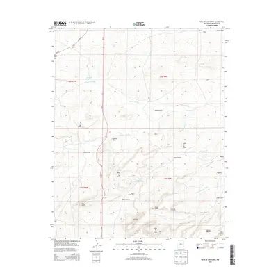
2013 Map of Mesa De Los Toros
USGS Topo · Published 2013About this map
Rancho Nuevo and Albers Ranch stand as primary landmarks in this McKinley County landscape, where the high desert is defined by a complex network of canyons and mesas. The drainage patterns of Milpitas Draw and Cañada Marcelina reveal the essential hydrology that sustained ranching in this territory. Names like Grandmas Swimming Pool offer a specific glimpse into local land use and community naming traditions, while the presence of Inditos Camp at the northern edge suggests a legacy of seasonal or mobile habitation. The topography is dominated by dramatic features such as Mesa de los Toros and Loma de los Toros, which overlook the deep incisions of Cañon Largo and Cañon Ancho. Local road networks like NM-509 and Coroad 19 provide the modern framework for navigating this historically significant terrain.
Find a feature on this map
34 named features on this map. Tap any name to fly to it.
Don’t see what you’re looking for? This feature index may not catch every label — zoom into the map to look around manually.
Map Details
Editions of this 2013 Mesa De Los Toros Map
This is the sole edition of this map. No revisions or reprints were ever made.
Other maps of this area

1883 · Mt. Taylor
USGS Topo · 1:250,000

1886 · Mt. Taylor
USGS Topo · 1:250,000

1892 · Mt. Taylor
USGS Topo · 1:250,000

1899 · Mt. Taylor
USGS Topo · 1:250,000

1957 · Ambrosia Lake
USGS Topo · 1:24,000

1957 · Goat Mountain
USGS Topo · 1:24,000

1958 · Albuquerque
USGS Topo · 1:250,000

1961 · Piedra De La Aguila
USGS Topo · 1:24,000

1961 · Hospah
USGS Topo · 1:24,000

1962 · Albuquerque
USGS Topo · 1:250,000