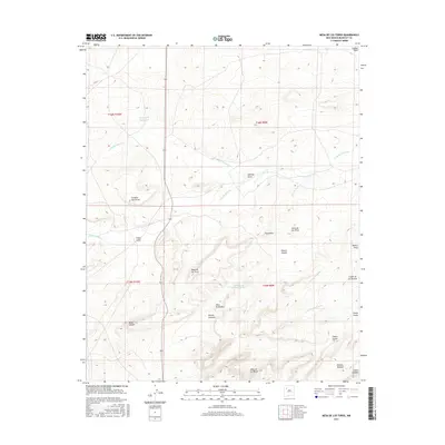
2017 Map of Mesa De Los Toros
USGS Topo · Published 2017About this map
Mesa de los Toros and its surrounding high-plateau terrain dominate this landscape in the Eastern Navajo Agency of New Mexico. The geography is defined by a series of dramatic mesas and winding canyons, including Cañon Largo and Cañon de los Alamos. Cultural and geographic landmarks such as Grandmas Swimming Pool provide specific points of interest amidst the seasonal watercourses of Cañada Marcelina and Cañada Milpitas. The map reveals a remote, sparsely populated territory where the primary infrastructure consists of rugged routes like Co RD 19. The concentration of Spanish-named features such as Loma de los Toros and Rincon Anzures highlights the region's heritage and the persistent connection between the land and the communities that navigate these high-elevation drainages and natural rimrocks.
Find a feature on this map
29 named features on this map. Tap any name to fly to it.
Don’t see what you’re looking for? This feature index may not catch every label — zoom into the map to look around manually.
Map Details
Editions of this 2017 Mesa De Los Toros Map
This is the sole edition of this map. No revisions or reprints were ever made.
Other maps of this area

1883 · Mt. Taylor
USGS Topo · 1:250,000

1886 · Mt. Taylor
USGS Topo · 1:250,000

1892 · Mt. Taylor
USGS Topo · 1:250,000

1899 · Mt. Taylor
USGS Topo · 1:250,000

1957 · Ambrosia Lake
USGS Topo · 1:24,000

1957 · Goat Mountain
USGS Topo · 1:24,000

1958 · Albuquerque
USGS Topo · 1:250,000

1961 · Piedra De La Aguila
USGS Topo · 1:24,000

1961 · Hospah
USGS Topo · 1:24,000

1962 · Albuquerque
USGS Topo · 1:250,000