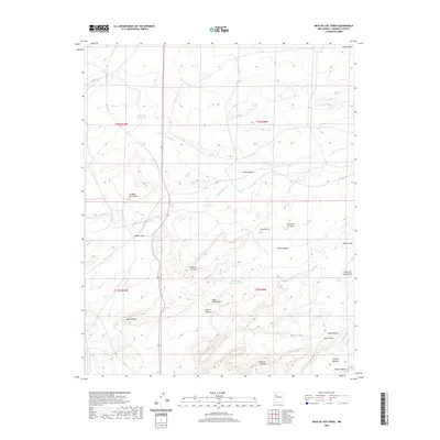
2020 Map of Mesa De Los Toros
USGS Topo · Published 2020About this map
Mesa de los Toros rises above a high desert landscape marked by complex drainage systems and prominent landforms within the Eastern Navajo Agency. The terrain is defined by a series of high flats and canyon systems, including La Mesa del Corral and Cañon Largo. Water, though sparse, has shaped the topography, as seen in the seasonal flows of Inditos Draw and Cañada Marcelina, alongside the curiously named Grandmas Swimming Pool. These features suggest a landscape where natural catchments were vital to local life and livestock management. Further south, the map details numerous named mesas and rincons, such as Mesa Redondita and Rincon Anzures, leading toward the southern reaches of Mesa de las Vacas and the white rock formations of Piedras Blancas.
Find a feature on this map
29 named features on this map. Tap any name to fly to it.
Don’t see what you’re looking for? This feature index may not catch every label — zoom into the map to look around manually.
Map Details
Editions of this 2020 Mesa De Los Toros Map
This is the sole edition of this map. No revisions or reprints were ever made.
Other maps of this area

1883 · Mt. Taylor
USGS Topo · 1:250,000

1886 · Mt. Taylor
USGS Topo · 1:250,000

1892 · Mt. Taylor
USGS Topo · 1:250,000

1899 · Mt. Taylor
USGS Topo · 1:250,000

1957 · Ambrosia Lake
USGS Topo · 1:24,000

1957 · Goat Mountain
USGS Topo · 1:24,000

1958 · Albuquerque
USGS Topo · 1:250,000

1961 · Piedra De La Aguila
USGS Topo · 1:24,000

1961 · Hospah
USGS Topo · 1:24,000

1962 · Albuquerque
USGS Topo · 1:250,000