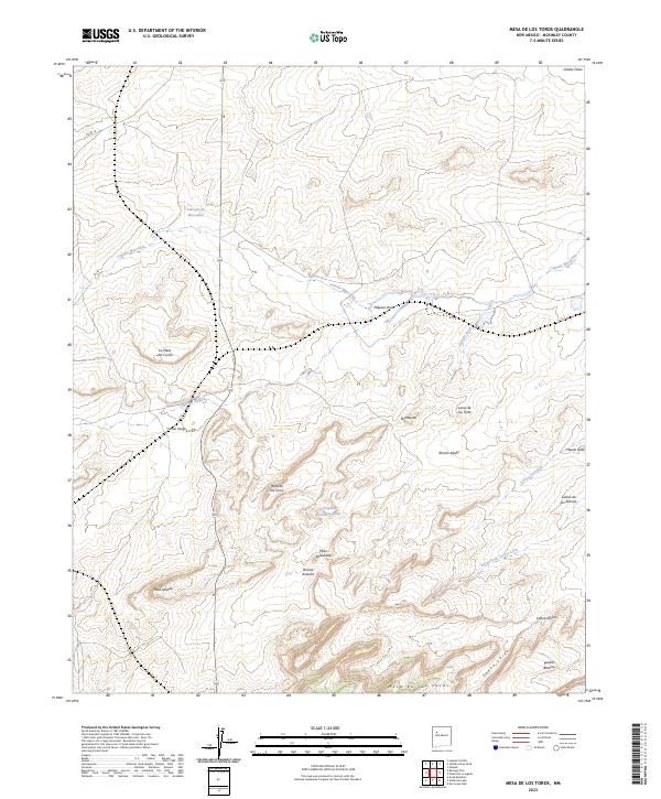
2023 Map of Mesa De Los Toros
USGS Topo · Published 2023About this map
Mesa de los Toros rises as a central plateau in this high-desert landscape of McKinley County, defined by a network of drainage systems and intricate topographical formations. The map details a rugged drainage pattern where Cañada Marcelina and Milpitas Draw carve through the northern sections, while Cañon Largo cuts a deep path to the south. Notable for its descriptive local nomenclature, the area includes landmarks like La Mesa del Corral and the uniquely named Grandmas Swimming Pool, a seasonal water feature in the center of the quadrangle.
Find a feature on this map
28 named features on this map. Tap any name to fly to it.
Don’t see what you’re looking for? This feature index may not catch every label — zoom into the map to look around manually.
Map Details
Editions of this 2023 Mesa De Los Toros Map
This is the sole edition of this map. No revisions or reprints were ever made.
Other maps of this area

1883 · Mt. Taylor
USGS Topo · 1:250,000

1886 · Mt. Taylor
USGS Topo · 1:250,000

1892 · Mt. Taylor
USGS Topo · 1:250,000

1899 · Mt. Taylor
USGS Topo · 1:250,000

1957 · Ambrosia Lake
USGS Topo · 1:24,000

1957 · Goat Mountain
USGS Topo · 1:24,000

1958 · Albuquerque
USGS Topo · 1:250,000

1961 · Piedra De La Aguila
USGS Topo · 1:24,000

1961 · Hospah
USGS Topo · 1:24,000

1962 · Albuquerque
USGS Topo · 1:250,000