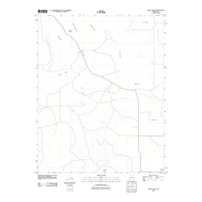
2010 Map of Mesa Larga
USGS Topo · Published 2010About this map
Laughlin Peak anchors the southern reaches of this landscape, which transitions into a series of distinctive landforms including Mesa Larga, Cedar Canyon Mesa, and Round Mesa. Small settlements such as Aragon, Cunico, and Moore are dispersed across the terrain, connected by a network of rural routes like County Road A 42. The area is characterized by its drainage patterns, with Blosser Arroyo and Green Mountain Arroyo cutting through the mesas, leading toward prominent elevations like Nipple Peak. This 2010 survey reflects a rural New Mexico ranching or agricultural environment where natural landmarks like Kiowa Flats and Loco Mesa remain the primary identifiers for residents and land managers.
Find a feature on this map
18 named features on this map. Tap any name to fly to it.
Don’t see what you’re looking for? This feature index may not catch every label — zoom into the map to look around manually.
Map Details
Editions of this 2010 Mesa Larga Map
This is the sole edition of this map. No revisions or reprints were ever made.
Other maps of this area

1912 · Raton
USGS Topo · 1:62,500

1914 · Raton
USGS Topo · 1:62,500

1954 · Raton
USGS Topo · 1:250,000

1958 · Raton
USGS Topo · 1:250,000

1971 · Kiowa
USGS Topo · 1:24,000

1971 · Tres Hermanos Peak
USGS Topo · 1:24,000
1971 · Hunter Mesa
USGS Topo · 1:24,000

1971 · Robinson Peak
USGS Topo · 1:24,000

1971 · Johnson Park
USGS Topo · 1:24,000

1971 · Pine Buttes
USGS Topo · 1:24,000