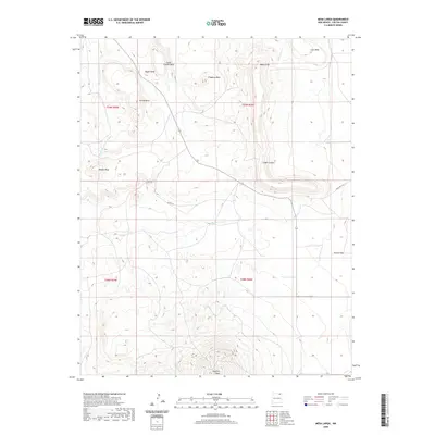
2020 Map of Mesa Larga
USGS Topo · Published 2020About this map
Laughlin Peak dominates the southern reaches of this high-altitude landscape, where volcanic geology and high-desert drainages define the character of Colfax County. The terrain is a complex series of elevated landforms, including the prominent Troyburg Mesa, Cedar Canyon Mesa, and the broad expanse of Mesa Larga. This modern topographical study illustrates how water has sculpted the region, with the Blosser Arroyo and Green Mountain Arroyo serving as primary conduits for seasonal runoff from the higher peaks and mesas.
Find a feature on this map
23 named features on this map. Tap any name to fly to it.
Don’t see what you’re looking for? This feature index may not catch every label — zoom into the map to look around manually.
Map Details
Editions of this 2020 Mesa Larga Map
This is the sole edition of this map. No revisions or reprints were ever made.
Other maps of this area

1912 · Raton
USGS Topo · 1:62,500

1914 · Raton
USGS Topo · 1:62,500

1954 · Raton
USGS Topo · 1:250,000

1958 · Raton
USGS Topo · 1:250,000

1971 · Kiowa
USGS Topo · 1:24,000

1971 · Tres Hermanos Peak
USGS Topo · 1:24,000
1971 · Hunter Mesa
USGS Topo · 1:24,000

1971 · Robinson Peak
USGS Topo · 1:24,000

1971 · Johnson Park
USGS Topo · 1:24,000

1971 · Pine Buttes
USGS Topo · 1:24,000